
Power line drone inspection · UK wide
Drone power line inspection across the UK
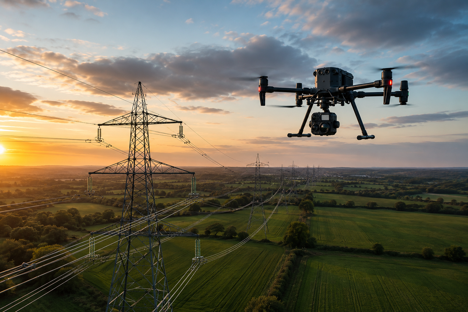
Capture detailed aerial imagery of overhead lines, pylons and associated electricity infrastructure using specialist commercial drone pilots matched to the requirements of the assignment.
Drone Assisted provides UK wide access to suitable drone capability for targeted inspection, asset condition imagery and repeat infrastructure monitoring, with specialist equipment and operating requirements assessed for every job.
Detailed aerial capture
High resolution imagery can provide detailed visual evidence of agreed components without relying solely on ground level observation.
Specialist pilot matching
Assignments are matched according to infrastructure experience, aircraft, sensors, competency and operating requirements.
Visual and thermal capability
Where appropriate, RGB and thermal data can be captured using suitably equipped aircraft and pilots.
UK wide network
Drone Assisted can coordinate suitable pilot capability for electricity infrastructure assignments across the UK.
How it works
- Step 01
Submit the inspection brief
Provide the asset type, location, line or structure to inspect, required imagery or data and any known site restrictions.
- Step 02
Assignment assessed
Drone Assisted reviews the required capture, environment, regulatory requirements, pilot capability, equipment and permissions.
- Step 03
Specialist pilot matched
Suitable verified pilot capability is identified according to the requirements of the assignment.
- Step 04
Capture and delivery
The agreed visual, thermal or other aerial data is captured and delivered according to the brief.
Pricing guidance
Power line drone inspection is quoted per assignment rather than from a fixed price list. Cost depends on the number of assets, route length, the level of inspection detail required, sensors, visual or thermal capture, the operating environment, required proximity, permissions, whether the work is a conventional Visual Line of Sight operation or a specialist operation, processing requirements, the deliverables agreed and the size of any repeat programme. Not every power line assignment can be accepted, so scope and feasibility are confirmed before a quote is issued.
Full UK drone pilot price guidePower line and electricity infrastructure inspection
Potential inspection scopes can include external visual capture of the following, subject to the agreed brief and the permitted operation.
Pylons and towers
Steelwork, visible corrosion, structural components, fittings, external condition and vegetation interaction where visible.
Conductors
Visual capture of conductor routes and externally visible areas where suitable stand off distances and operating conditions permit.
Insulators
Detailed imagery of insulator assemblies where suitable equipment, operating distance and environmental conditions allow useful capture.
Crossarms and fittings
Visual evidence of agreed external components and connections.
Overhead line corridors
Aerial imagery providing context around line routes, vegetation and surrounding conditions.
Substation external infrastructure
External aerial data where the assignment, site rules and operating environment permit drone use.
Aerial imagery records what is externally visible at the time of capture. It cannot identify every electrical or structural fault from imagery alone.
What can aerial inspection data show?
High resolution imagery may help suitably qualified specialists identify or investigate visible indicators such as:
- Corrosion
- Damaged components
- Missing or displaced fittings
- Visible insulator damage
- Vegetation encroachment
- Foreign objects
- External deterioration
- Storm related damage
- Unusual visible asset conditions
Imagery can provide evidence of these indicators and can support identification of areas warranting closer attention. It does not, in itself, confirm a cause.
Drone Assisted primarily provides aerial data capture. Electrical, structural and asset condition interpretation remains the responsibility of appropriately qualified professionals unless specialist interpretation is explicitly included within the agreed assignment.
High resolution visual inspection
Appropriately equipped drones can capture detailed RGB imagery from agreed viewpoints and distances. Potential outputs include:
- Overview imagery
- Component level photographs
- Tower or pylon imagery
- Conductor imagery where appropriate
- Close detail imagery where the operation permits
- High resolution video
- Geo referenced files where agreed
Required image resolution and stand off distance should be defined as part of the assignment brief, because they determine the aircraft, sensor and operating method needed. Close proximity flight around live infrastructure is never assumed and is only considered where the asset owner, environment and permitted operation allow it.
Thermal drone inspection of electricity infrastructure
Thermal cameras can identify temperature differences which may warrant further investigation. Potential applications may include suitable inspection of:
- Electrical connections
- Selected substation components
- Equipment showing abnormal heat patterns
- Other externally visible electrical infrastructure
Thermal usefulness depends on sensor capability, distance, electrical load, environmental conditions, weather, emissivity, viewing angle, methodology and specialist interpretation.
Thermal imagery identifies temperature patterns or anomalies for further investigation rather than automatically determining the underlying cause. For the wider thermal capability across buildings, roofs and assets, see thermal drone surveys.
Power line corridor and vegetation monitoring
Aerial imagery may support assessment of vegetation proximity, tree growth, access routes, surrounding terrain, line corridor condition, storm impacts and areas requiring further investigation.
Standard aerial photography provides visual context rather than survey grade clearance measurement. Where mapping or spatial measurement is required, see drone mapping for orthomosaics and spatial datasets, and drone surveying where measurement accuracy is the priority.
Targeted drone inspections
Many assignments involve targeted inspection of:
- Specific towers
- Individual pylons
- Identified sections of overhead line
- Assets requiring closer visual evidence
- Suspected damage following an event
- Maintenance areas
These assignments may be suitable for conventional Visual Line of Sight operations depending on the location, aircraft, airspace and proposed operation. Targeted work of this kind is often the quickest route to useful imagery, because it avoids the additional requirements associated with longer range operations.
BVLOS power line inspection
Beyond Visual Line of Sight operations can potentially support inspection across longer infrastructure routes, and UK regulation is evolving to enable greater use of BVLOS for infrastructure inspection, including power lines.
Drone Assisted does not automatically provide BVLOS operations on every assignment. BVLOS operations require:
- Appropriate regulatory approval
- An operator authorised for the proposed operation
- Suitable operational procedures
- Appropriate aircraft and systems
- Site specific assessment
- Compliance with applicable CAA requirements
Where a BVLOS assignment is requested, Drone Assisted assesses whether suitably authorised specialist capability is available for that operation.
Operating BVLOS within an Atypical Air Environment requires an appropriate CAA Operational Authorisation. Proximity to a power line does not by itself create an Atypical Air Environment, and the Atypical Air Environment framework does not remove the requirement for an Operational Authorisation.
Drones and the future of UK infrastructure inspection
Drone inspection is increasingly being adopted within UK electricity infrastructure, where aerial imagery can supplement ground based inspection and support maintenance planning.
UK aviation regulation is also developing routes for greater use of BVLOS operations around infrastructure such as power lines. Current requirements are published by the UK Civil Aviation Authority, and network operators such as National Grid publish information about how they manage and maintain transmission assets.
Rapid visual assessment following damage
Targeted aerial capture may be useful following severe weather, storm damage, fallen vegetation, suspected external damage, asset incidents or access restrictions.
Drone imagery can provide initial visual evidence to asset owners and specialists ahead of physical access. Attendance times depend on pilot availability, weather, airspace and site permissions, so they are confirmed per enquiry rather than guaranteed. Imagery records visible external condition only and does not determine whether infrastructure is safe to energise or operate.
One off or repeat power line inspection
Work can potentially include:
- Individual asset inspection
- Targeted line section inspection
- Scheduled condition monitoring
- Annual inspection support
- Post event capture
- Before and after imagery
- Repeat infrastructure programmes
The Drone Assisted network model is particularly suitable for organisations managing assets across multiple UK regions. Repeat viewpoints can be planned where operationally practical, although exact repetition of every flight cannot be guaranteed because weather, airspace and site conditions vary between visits.
UK wide utility inspection programmes
Customers with assets across different regions can use one managed service rather than independently sourcing individual drone pilots for every location.
Assignments can work from a common specification covering required assets, imagery, sensors, naming conventions, deliverables, pilot competency, site procedures and reporting requirements. Pilots are then matched locally according to capability and availability, with coverage across England, Scotland, Wales and Northern Ireland. Availability of every specialist capability in every location cannot be guaranteed, so each site is confirmed individually.
Inspection data for engineering teams
Drone Assisted provides the aerial evidence. Qualified infrastructure professionals make the engineering decisions.
Drone imagery can support engineers, asset managers, maintenance teams, network operators and inspection specialists. It does not by itself provide electrical certification, structural certification, asset safety sign off, engineering approval or statutory inspection sign off, unless appropriately qualified services have specifically been included in the assignment.
Planning drone operations around electricity infrastructure
Depending on the proposed operation, an assignment may require assessment of live electrical infrastructure, the electromagnetic environment, safe stand off distances, site access, surrounding land, roads, railways, members of the public, controlled airspace, nearby aviation, asset owner procedures, RAMS, specialist PPE, environmental conditions, aircraft suitability, sensor requirements, whether the work is a VLOS or BVLOS operation, and Operational Authorisation where required.
Not every assignment involves all of these. Requirements are assessed according to the proposed operation, and that assessment determines which pilot, aircraft and permissions are needed. See commercial drone pilot requirements for how pilots are checked.
Related specialist services
- Drone infrastructure inspection for broader infrastructure assets including bridges, towers and industrial structures.
- Thermal drone surveys for specialist thermal capture.
- Drone surveying for measurement focused projects.
- Drone mapping for orthomosaics and spatial datasets.
- General drone inspection for wider building, property and asset inspection.
- Request a power line inspection quote to submit an assignment and confirm availability.
Frequently asked questions
Can drones inspect power lines?
Drones can capture detailed aerial imagery of suitable overhead line infrastructure, including towers, fittings and line corridors. What can be captured depends on the operating environment, the airspace, the asset owner requirements and the agreed assignment brief, so each enquiry is assessed individually.
Can drones inspect live power lines?
Inspection around live electricity infrastructure requires careful planning, suitable stand off distances, appropriate aircraft and specialist pilot capability, agreed with the asset owner. It is not something that can be promised for every site or every assignment.
Can drones detect faults on power lines?
Visual and thermal data can reveal indicators or anomalies such as corrosion, damaged components or unusual heat patterns. Their significance is determined by appropriately qualified professionals. The imagery supports investigation rather than diagnosing an electrical fault by itself.
Can drones inspect pylons?
Yes. Suitable external components such as steelwork, fittings, insulator assemblies and visible structural condition can be captured where the proposed operation, environment and permissions allow.
Do power line drone inspections require BVLOS?
No. Many targeted inspections of individual towers or short line sections can potentially be undertaken within Visual Line of Sight. Longer route inspections may involve Beyond Visual Line of Sight operations, which carry additional regulatory requirements including appropriate CAA approval.
Can Drone Assisted provide power line inspections anywhere in the UK?
The network covers England, Scotland, Wales and Northern Ireland. Availability for any individual assignment is confirmed according to specialist capability, location, regulatory requirements and the complexity of the proposed operation.
Ready to get started?
Drone Assisted operates a growing UK wide pilot network and confirms suitable capability and availability for each assignment. Identity, commercial insurance and job specific qualifications are checked where required.
Discuss a power line inspection