

ConstructionProject gallery
Urban construction progress capture
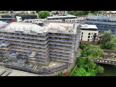
An aerial view of a multi storey development, its roof decks, scaffolding and surrounding streets.
Construction progress monitoring · UK wide
Track construction projects with consistent aerial imagery and repeat drone capture throughout the build. Drone Assisted provides UK wide construction progress monitoring through verified and commercially insured drone pilots.
Assignments can be scheduled at agreed intervals to create a clear visual record of site progress, support stakeholder reporting and provide repeatable aerial documentation from key stages of a project.
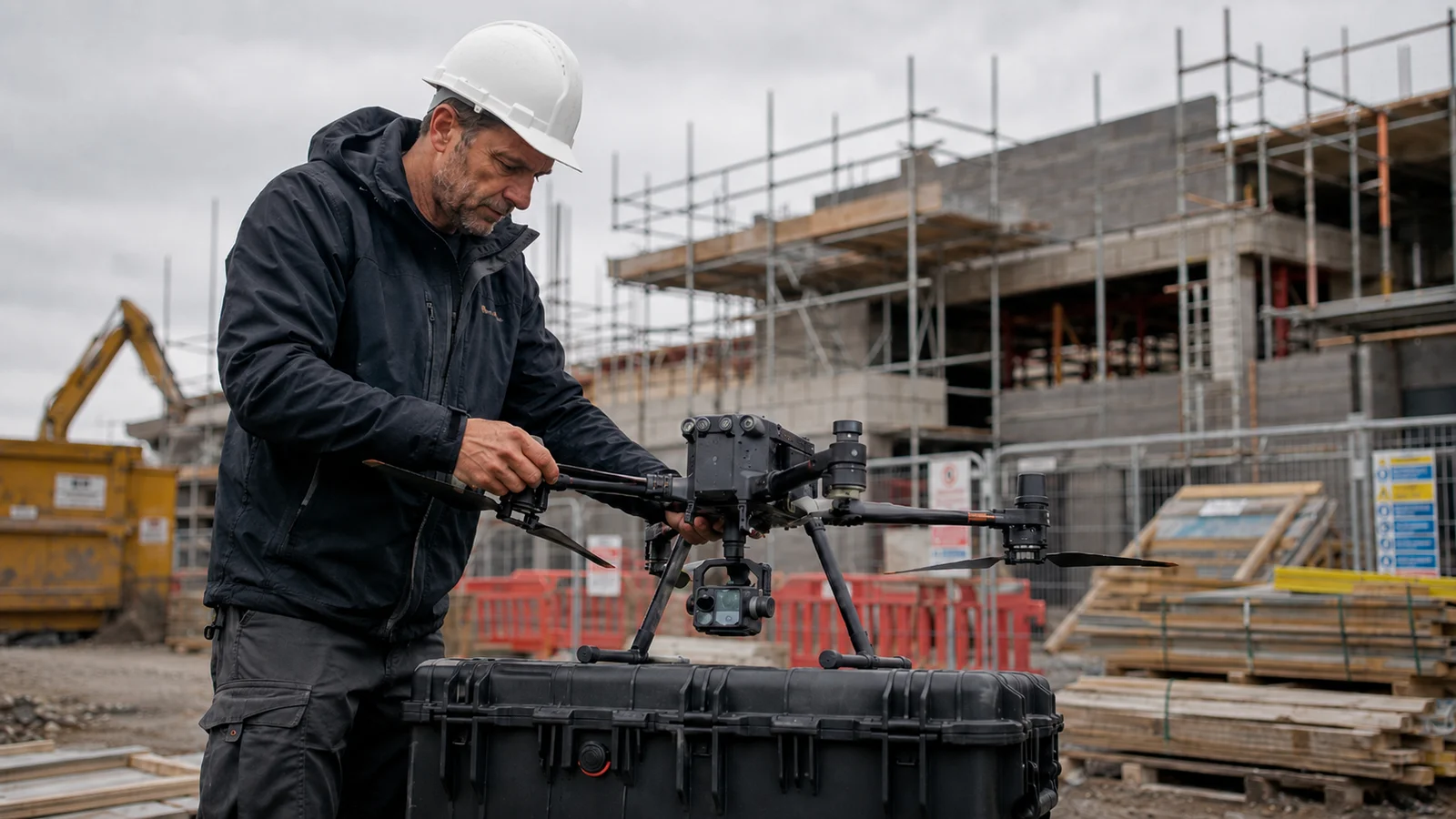
Agree viewpoints, areas of interest and capture requirements so progress can be compared consistently across repeat visits.
Construction assignments are matched to suitable pilots across the UK based on location, capability and project requirements.
Build a chronological aerial record showing how a site changes throughout key stages of construction.
Schedule capture weekly, monthly, at project milestones or at another frequency agreed for the project.
Brief Drone Assisted once and we handle matching, scheduling, quality review and secure delivery for each visit.
Pilots are checked for identity, commercial insurance and CAA registration, with job specific qualifications and site credentials checked where the project requires them.
Site location, project type, required outputs, planned monitoring frequency and relevant site information.
We assess the capture requirements, operating environment, required equipment and the pilot capability the work calls for.
A verified pilot with suitable capability is matched according to the assignment requirements and location.
The site is captured at the agreed stage or interval and the agreed imagery or data is securely delivered.
Pricing guidance
There is no fixed price for construction progress monitoring. Cost depends on site size, visit frequency, location, the imagery required, whether mapping or other specialist outputs are needed, flight complexity, processing requirements and whether the assignment is one off or recurring. Recurring programmes are usually quoted per visit against an agreed brief.
Full UK drone pilot price guideDrone construction progress monitoring uses repeat aerial capture to build a high level visual record of how a site develops. Depending on the brief, that record can cover:
The exact scope, areas of interest and outputs are agreed before the first assignment so every visit is captured against the same expectations.
Drone imagery provides visual evidence of site conditions at the time of capture. It does not by itself constitute professional certification of construction quality, contractual completion or regulatory compliance.
See how whole site views, selected work areas and planned viewpoints can support a useful progress record. This example shows one visit; comparisons over time require further capture.
Site wide visibility and repeat visual records throughout the programme.
Independent visual updates showing how a development is progressing over time.
Additional aerial context that can support project reviews and progress discussions.
Clear imagery suitable for project updates, presentations and stakeholder communication.
Visual records showing development of the site and external structures.
Drone Assisted supplies aerial capture and imagery. It does not act as a quantity surveyor, architect or construction certifier.
Outputs are agreed according to the project. Potential deliverables include:
Wide site views and detailed photographs of agreed areas.
Images captured from planned positions, or comparable viewpoints, where operationally practical.
Short progress footage or site overview video where included within the brief.
Organised imagery from individual visits to create a chronological project record.
Where suitable mapping capability is required and available, overlapping aerial capture may support an orthomosaic or other agreed mapping output.
Where specifically required, appropriately equipped pilots may capture data suitable for mapping or three dimensional outputs.
Where the methodology, equipment and intended use are appropriate, mapping data may support stockpile or earthworks volume analysis.
Mapping, models, volumes and survey grade outputs are specialist requirements rather than a standard part of progress monitoring, so they are agreed and capability matched before the assignment. For projects that need spatial datasets, see drone mapping services or drone surveying.


Drone Assisted can support:
For ongoing work, a consistent brief is agreed at the outset covering:
That brief travels with the project, so a repeat visit follows the same expectations even where a different pilot attends. Attendance on any specific date remains subject to weather, airspace, site activity and safety considerations, and visits are rescheduled where conditions do not allow safe capture.
Companies managing developments or assets in several regions can submit every assignment through one Drone Assisted service instead of sourcing, checking and contracting a separate operator for each location. Coverage spans England, Scotland, Wales and Northern Ireland.
Pilots are matched per site according to:
Standard progress imagery is the most widely available requirement. Specialist capability is not available in every postcode, so availability is confirmed per site before work is committed.
Live sites change constantly, so practical considerations are assessed before each assignment, including:
Credentials are matched to the project rather than assumed. Where a site requires a particular qualification, competency or credential, such as a specific card scheme, site accreditation, GVC or an Operational Authorisation covering the intended operation, we confirm that a pilot holding it is available before the assignment proceeds.
Primarily repeat visual documentation of a project: imagery, video and a chronological record of progress.
Used where the project requires defined spatial, measurement or survey outputs. See drone surveying.
Used where orthomosaics, point clouds, models or other spatial datasets are required. See drone mapping.
For one off property marketing imagery or a completed development film, see our drone photography and videography service.
Where the requirement is asset or defect focused rather than programme focused, drone inspection is usually the better fit. Many projects combine more than one of these, and a single brief can cover them.
Progress monitoring can be arranged for projects such as:
Tell us the project type and location and we will confirm whether suitable pilot capability is available. Check pilot availability or read the UK drone pilot price guide.
Our work
An aerial view of a multi storey development, its roof decks, scaffolding and surrounding streets.
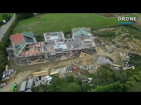
A building under construction, captured from several sides to show its roof structure, footprint and surroundings.
Capture can be arranged weekly, monthly, at project milestones or at another interval agreed for the project. Attendance on any given date remains subject to weather, airspace, site access and safety considerations.
Planned viewpoints and a consistent brief improve comparability between visits. Exact repetition cannot be guaranteed, because weather, cranes, temporary works, site activity, airspace and safety requirements can all affect how a site is flown on the day.
Yes. Assignments across several regions can be submitted through one Drone Assisted service rather than sourcing a separate operator per location, subject to suitable pilot availability for each site.
Deliverables follow the agreed brief. They commonly include high resolution imagery of the site and agreed areas, and can also include video, organised time stamped progress records or specialist outputs where these have been agreed in advance.
These may be available where the required equipment, methodology and processing capability are agreed and a suitably equipped pilot is matched. They are not included as standard on progress monitoring assignments. See our drone mapping services for spatial outputs.
No. Drone imagery provides visual evidence of site conditions at the time of capture. It does not by itself constitute professional certification of construction quality, contractual completion, valuation or regulatory compliance.
Drone Assisted operates a growing UK wide pilot network and confirms suitable capability and availability for each assignment. Identity, commercial insurance and job specific qualifications are checked where required.
Discuss your construction project