

InfrastructureProject gallery
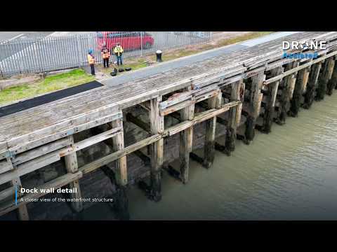
Dockside infrastructure capture
Wide waterfront views and close detail of dock structures, captured on a Drone Assisted assignment.
Infrastructure drone inspection · UK wide
Inspect bridges, towers, utilities, industrial structures and other infrastructure using high resolution aerial data captured by verified commercial drone pilots across the UK.
Drone Assisted matches each assignment to suitable pilot capability, equipment and operating requirements, providing agreed imagery and data for asset owners, engineers, maintenance teams and specialist consultants.
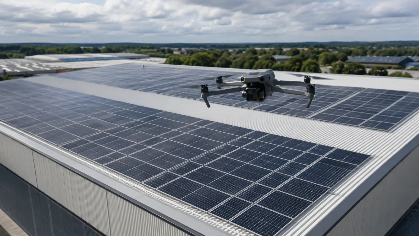
Capture external areas that may otherwise require specialist access equipment, subject to the operating environment.
Use the Drone Assisted network for infrastructure assignments across multiple UK regions.
Assignments are matched according to asset type, equipment, pilot competency and operating requirements.
Where appropriate, repeat capture can support comparison of visible asset condition over time.
Provide the asset type, location, areas requiring inspection, required outputs and any site restrictions.
Drone Assisted assesses the operating environment, equipment needs, permissions, pilot capability and deliverables.
The assignment is matched to a verified pilot with capability appropriate to the proposed work.
The agreed aerial data is captured and delivered according to the assignment specification.
Pricing guidance
Infrastructure drone inspection pricing varies significantly by assignment. Asset type, the number of assets, site complexity, required proximity, the flight environment, specialist equipment and sensors, required deliverables, travel, permissions and any repeat programme requirements all affect the quote. Each enquiry is priced individually.
Full UK drone pilot price guideExternal surfaces, decks where visible, piers, abutments, structural elements and difficult to view areas where the proposed operation allows safe capture.
External components, antennas, mounts, cabling and visible structural condition where suitable equipment and operating conditions allow.
External utility assets, supporting structures and associated infrastructure according to the agreed scope.
Chimneys, stacks, tanks, silos, gantries, industrial roofs and external plant.
Selected renewable and energy assets where appropriate pilot capability, sensors and permissions are available.
External infrastructure associated with roads, rail, ports and other transport environments where site access and operational permissions can be agreed.
Not every type of infrastructure assignment can automatically be undertaken. Some environments require specialist competency, specific aircraft, particular sensors, Operational Authorisation, site owner permission, airspace permission, additional method statements, specialist induction or coordination with infrastructure operators. These requirements are assessed for each assignment before a pilot is matched.
Drone capture can record high resolution visual evidence of accessible external bridge elements without requiring personnel to access every area solely for photography. What can be reached depends heavily on the structure, its surroundings and the permitted operation, so underside and close proximity capture is assessed case by case rather than assumed.
Depending on the agreed brief and safe operating conditions, capture may include:
Drone imagery is inspection data. Structural interpretation, engineering assessment and certification remain the responsibility of appropriately qualified professionals.
Aerial capture may support visual inspection of tower structures, antennas, mounts, dishes, external cabling, fixings, corrosion indicators, visible damage and general asset condition.
Telecom environments can present specialist operational considerations, including electromagnetic interference, proximity to structures, asset height, the surrounding environment, airspace and safe stand off distances. For that reason these assignments are capability matched to pilots with relevant experience, equipment and permissions. Not every pilot in the network is suitable for tower work.
Aerial data capture may suit power infrastructure, utility structures, renewable assets, energy sites, pipelines where externally visible and associated industrial infrastructure, according to the agreed scope.
Electricity infrastructure requires particular care. Drone Assisted does not automatically undertake close proximity high voltage inspection. Scope, equipment, permissions and operating requirements are assessed with the asset owner before an assignment is accepted. For overhead lines, pylons and electricity networks specifically, see drone power line inspection.
Where temperature differences are relevant to the brief, see thermal drone surveys, and for module level fault indication across arrays see solar panel drone inspection.
Industrial assignments commonly cover chimneys, stacks, tanks, silos, gantries, warehouses, industrial roofs, external plant and other high level structures.
Drone inspection is most useful where the primary requirement is gathering visual evidence from difficult to view external areas. It does not replace non destructive testing, physical testing, intrusive inspection, engineering inspection or specialist certification, all of which require physical access and qualified professionals.
One viewpoint rarely explains an entire industrial asset. This guide compares side and elevated silo footage, showing why coverage, targeted detail and clear image labels should be agreed in the inspection brief. External imagery does not establish internal condition, wall thickness or structural safety.
Deliverables are agreed before the assignment. Depending on that brief, outputs may include:
A formal engineering inspection report is only provided where the assignment specifically includes an appropriately qualified specialist.
Capturing aerial imagery or data according to an agreed brief, delivered in the agreed format.
Engineering interpretation, structural assessment, non destructive testing interpretation, certification or professional sign off where required.
Drone capture provides engineers, inspectors, asset managers and other specialists with better visual evidence. It does not replace professional engineering judgement or statutory inspection requirements.
Infrastructure operators, utilities and service companies managing assets across different regions can use one managed network instead of independently sourcing a local drone pilot for every location. Coverage spans England, Scotland, Wales and Northern Ireland.
Drone Assisted can work from a consistent assignment specification across a portfolio while matching local pilot capability to each site, so outputs stay comparable between regions and procurement stays with a single point of contact. Availability at any individual site is confirmed according to location, asset type and specialist requirements.
Assignments can be structured as:
Repeat viewpoints and capture can be planned where operationally practical. Exact repeat flight paths cannot be guaranteed, because weather, site activity, temporary works, airspace and safety requirements affect how an asset is flown on the day.
Aerial capture can provide timely visual evidence following storm damage, accidental damage, suspected external deterioration, maintenance issues, impact damage or other asset incidents, before deciding whether physical access or specialist investigation is required.
The same evidence can support insurers, loss adjusters and asset managers reviewing a claim or a maintenance decision. Imagery records visible external condition at the time of capture; it does not determine liability or cause, which remain matters for appropriately qualified professionals. See also drone surveys for insurance claims.
Complex infrastructure assignments can involve factors such as controlled airspace, nearby roads or railways, members of the public, critical infrastructure security, RF or electromagnetic environments, high structures, restricted sites, site inductions, client RAMS requirements, specialist PPE, permissions from asset owners, particular aircraft or sensors, and Operational Authorisation where required.
Not every assignment involves all of these. Requirements are assessed per job, and the outcome of that assessment determines which pilot, aircraft and permissions are needed. See commercial drone pilot requirements for more detail on how pilots are checked.
Drone infrastructure inspection suits large, specialist, industrial, utility, transport and infrastructure assets, where competency, permissions and equipment matching matter as much as the capture itself.
General drone inspection suits wider property, roof, building and commercial inspection requirements. For those, see our drone inspection services.
Our work
Wide waterfront views and close detail of dock structures, captured on a Drone Assisted assignment.
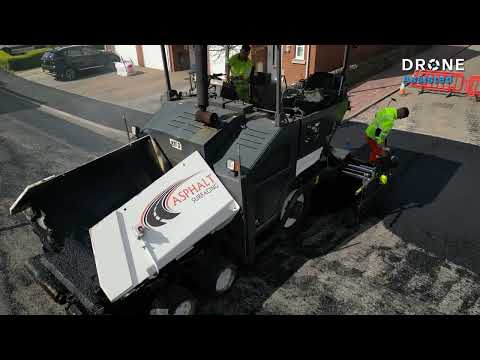
Real footage of road paving and rolling, with the work area shown in the context of a residential street.
Bridges, telecom towers and masts, utility structures, industrial assets such as chimneys, stacks, tanks and silos, selected energy assets and external transport infrastructure. Every enquiry is assessed individually, because the asset, site, airspace and required outputs determine whether the assignment can be undertaken and which pilot capability is needed.
Drones can capture visual data from accessible external bridge areas such as parapets, piers, abutments, steelwork and masonry where the proposed operation allows safe capture. Structural assessment, interpretation and certification remain the responsibility of appropriately qualified professionals.
Yes, where suitable pilot capability, equipment, permissions and operating conditions are available. Telecom environments carry specialist considerations such as electromagnetic environments, asset height and safe stand off distances, so these assignments are capability matched rather than allocated to any pilot.
Drone Assisted operates a UK wide network covering England, Scotland, Wales and Northern Ireland. Availability for any individual assignment is confirmed according to location, asset type, permissions and the specialist requirements of the work.
No. Drone capture provides imagery and data. Engineering judgement, structural assessment, non destructive testing interpretation, certification and statutory inspection requirements rest with appropriately qualified professionals.
Repeat capture can be arranged to support visual comparison of asset condition over time where operational conditions allow comparable capture. Exact repetition of flight paths and viewpoints cannot be guaranteed, because weather, site activity, airspace and safety requirements vary between visits.
Drone Assisted operates a growing UK wide pilot network and confirms suitable capability and availability for each assignment. Identity, commercial insurance and job specific qualifications are checked where required.
Request an infrastructure inspection